File:LocationMalaysia.png
No higher resolution available.
LocationMalaysia.png (250 × 115 pixels, file size: 5 KB, MIME type: image/png)

|
This locator map image could be re-created using vector graphics as an SVG file. This has several advantages; see Commons:Media for cleanup for more information. If an SVG form of this image is available, please upload it and afterwards replace this template with
{{vector version available|new image name}}.
It is recommended to name the SVG file “LocationMalaysia.svg”—then the template Vector version available (or Vva) does not need the new image name parameter. |
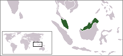
Location map for the Malaysia.
Originally created for English Wikipedia by Vardion.
| |
This work has been released into the public domain by its author, Vardion, at the English Wikipedie project. This applies worldwide. In case this is not legally possible: |
File history
Click on a date/time to view the file as it appeared at that time.
| Date/Time | Thumbnail | Dimensions | Usere | Comment | |
|---|---|---|---|---|---|
| current | 04:07, 7 auguste 2008 | | 250 × 115 (5 KB) | Lauyulam | Location map for the Malaysia.<br/>Originally created for English Wikipedia by Vardion. {{PD-user-w|en|English Wikipedia|Vardion}} {{to SVG|map}} Category:Locator maps of countries Category:Malaysia |
| 07:11, 14 desembre 2004 |  | 250 × 115 (6 KB) | EugeneZelenko | Location map for the Malaysia.<br/>Originally created for English Wikipedia by Vardion.<br/>{{PD}}<br/>Category:Country locator maps |
Linkes
The following page uses this file:
Global file usage
The following other wikis use this file:
- Usage on ar.wikipedia.org
- Usage on ar.wikinews.org
- فعاليات تضامن بماليزيا مع إضراب الأسرى
- قالب:ماليزيا
- حملة "أنقذوا القدس" بماليزيا تبحث سبل صد العدوان عن الأقصى
- ماليزيا تعلن العثور على جثتي طاقم المقاتلة المنكوبة
- مسيرات في ماليزيا نصرةً للأقصى
- حريق في مدرسة دينية بماليزيا يودي بـحياة 25 شخصاً
- انطلاق مؤتمر لتعزيز الفرص التعليمية في ماليزيا
- أشباح غابات ماليزيا
- أزمة في صباح بعد اشتباك ماليزيا مع قوات فلبينية مسلحة
- Usage on arz.wikipedia.org
- Usage on as.wikipedia.org
- Usage on az.wikipedia.org
- Usage on bg.wikipedia.org
- Usage on bn.wikipedia.org
- Usage on bpy.wikipedia.org
- Usage on ca.wikipedia.org
- Usage on de.wikinews.org
- Usage on de.wikivoyage.org
- Usage on dsb.wikipedia.org
- Usage on en.wikipedia.org
- Usage on en.wikinews.org
- Wikinews:Template messages/Infoboxes/Countries
- Template:Malaysia
- Malaysian court rules Christian woman can't remove Islam from ID
- Malaysian fans riot at delayed opening of Indian film
- Politically charged murder trial under way in Malaysia
- Maid's escape from high-rise leads to crackdown on agencies in Malaysia
- Anwar's lawsuit over gay slur by former Malaysian premier is dismissed
- Malaysian government warns citizens about Uncyclopedia
- Malaysian Prime Minister dissolves Parliament, makes way for elections
- Malaysian general election 2008 update
- Malaysian opposition gains in elections, conquers four new state legislatures
- Multifaith council commends Malaysian politician's comments on conversion to Islam
- Jenson Button wins half of the 2009 Malaysian Grand Prix points
- Guard rail kills ten in Malaysian bus crash
- Macaque kills newborn in Malaysia
- Australia, Malaysia closing in on refugee agreement
- Usage on en.wikivoyage.org
- Usage on en.wiktionary.org
- Usage on eo.wikipedia.org
- Usage on es.wikipedia.org
View more global usage of this file.